The Weekend That Was: A Waterfall Adventure in Kiambu
Ladies and gentlemen,
Brace yourselves for another long post, because this adventure was too good not to share!
This time, three friends and I ventured deep into Kiambu County on a mission: to find a breathtaking waterfall with an identity crisis. Seriously, its name remains a mystery. A Google search suggested ‘Githombokone,’ but the landowner begged to differ. He had no alternative name for it, though—so let’s leave the naming drama aside and get to the fun part!
The Journey Begins
The waterfall is somewhere in Gatundu North, so we hopped onto public transport from Nairobi to Jomoko, then switched to another matatu that took us to Gakoe Market—the end of the matatu line. This is where things got interesting.
One of us had done some “extensive research” (read: a quick Google Maps search) and was confident that the waterfall was a short hike from Gakoe. But when we asked the locals, their response was, “Waterfall? What waterfall?” Even the rangers from the nearby Kieni Forest had no idea what we were talking about. Yet, according to our map, the falls were a solid 14 km away.
Enter the Real Guides: Bodaboda Riders
Premium tip: If you’re ever lost in the villages, forget Google Maps. The bodaboda riders know every rock, river, and random tree. No debate. No discussion. Case closed.
Just as we were about to give up, we found a bodaboda rider who had escorted another lost group two weeks earlier. He pulled out his phone, showed us photos, and—bingo!—they matched the ones we were looking for.
Now, 14 km of village roads is no joke. There were no matatus, and walking was out of the question. We haggled with two boda guys to ferry us there, guide us to the falls, wait for us as we swam, took photos, and goofed around, then bring us back. Best decision ever!
The “road” was an adventure on its own—half-tarmacked, with potholes big enough to trap an elephant. Honestly, it felt like the potholes had tarmac patches instead of the other way around. We zipped through avocado and tea farms, knowing full well that one wrong move (or one madman yelling ‘Thief!’) could turn us into an unfortunate news headline.
The Grand Reveal: A Hidden Gem
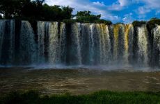
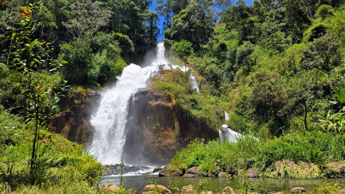
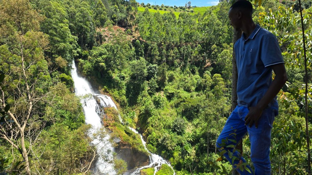
After navigating steep slopes that could give rock climbers nightmares, we arrived. And wow—it was worth every bump and bruise. This waterfall is a true giant, likely one of the tallest in Kiambu, possibly even among the top 15 in the country.
Water thundered down in a breathtaking cascade before merging with the mighty Chania River. What river was feeding the falls? No one knew—not even the elderly landowner. However, he was certain it was an outlet from Ndakaini Dam, built in 1991. A quick Google check confirmed his story—respect to the OG tour guides!
The Return Journey: Round Two
I won’t bore you with the details of our grueling hike back to the bodas. Let’s just say, if you’re unfit or afraid of heights, this is NOT your playground.
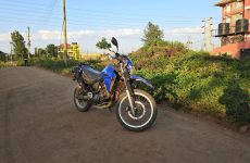
Fast forward: I posted a video, and my friend Sam was so impressed that he demanded we go back the next day. So, round two happened—this time on motorcycles. No boda guys, just us and the open road. We went straight to the landowner’s home, and he not only guided us again but also showed us a better access route and a hidden Mau Mau command center from the independence struggle.
Planning Your Visit? Here’s Your Cheat Sheet:
- Public Transport Route:
- Nairobi → Jomoko → Gakoe.
- From Gakoe, ask for directions to Mataara Police Post, St. Patrick Mataara Catholic Church, and Ndunduini Tea Collection Point.
- From there, you’ll find ‘Kwa Mzee,’ where the waterfall is located.
- Private Vehicle/Motorcycle Route:
- From Jomoko, take the Thika-Mangu Road.
- At Gatukuyu, take a right and drive to Mataara Police Post.
- Continue to St. Patrick Catholic Church, then to Ndunduini Tea Collection Centre.
- From there, it’s a rough 2 km off-road adventure.
I’m working on mapping out these hidden gems—watch this space for updates! Haha!